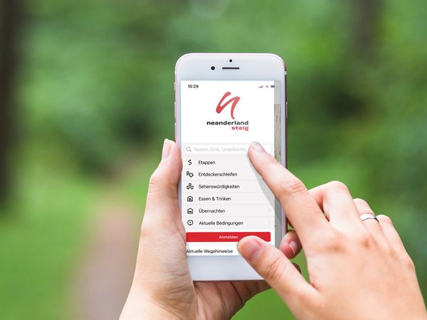
The newly launched neanderland STEIG hiking app makes it easy to plan a trip on the neanderland STEIG and the neanderland STEIG discovery loops, to enjoy them stress-free and to keep them in good memory. The program is now available for free download for iOS and Android devices. Everyone who uses the previous hiking app will automatically receive the new version with the next update.
"With the new free hiking app and the improved menu, it's even easier to find hiking routes, distances, restaurants, accommodation, places of interest and parking spaces," explains Julia Pölcher, coordinator of destination management at neanderland tourism. Using a filter function, users can, among other things, display routes of a certain length and difficulty, check whether inns are currently open or barrier-free, but also search for hotels, holiday apartments and campsites. The app offers voice navigation during the tour and a recording of the route covered. Hiking enthusiasts can then save them together with photos as a reminder in their profile. Particularly interesting for guests from the nearby neighboring countries: The hiking app is bilingual - in German and in English.
If you want to implement sporty New Year's resolutions or just want to be inspired by the diverse routes in the region, you can use the new app to get active immediately and explore the stages of the neanderland STEIG and the themed discovery loops that branch off from it. Stage 6 offers an exciting detour into the Ruhr area from Velbert to Essen-Kettwig and stage 13 leads through Monheim to Gänseliesel and Vater Rhein. The neanderland STEIG discovery loop "Wasserburg Haus Graven" in Langenfeld is a leisurely walk of just 1,9 kilometers in length. All information about downloading the new hiking app can be found on the website www.neanderlandsteig.de.
Contact
neanderland / District of Mettmann, Tel. 02104-991199
info(at)neanderland.de | www.neanderland.de
